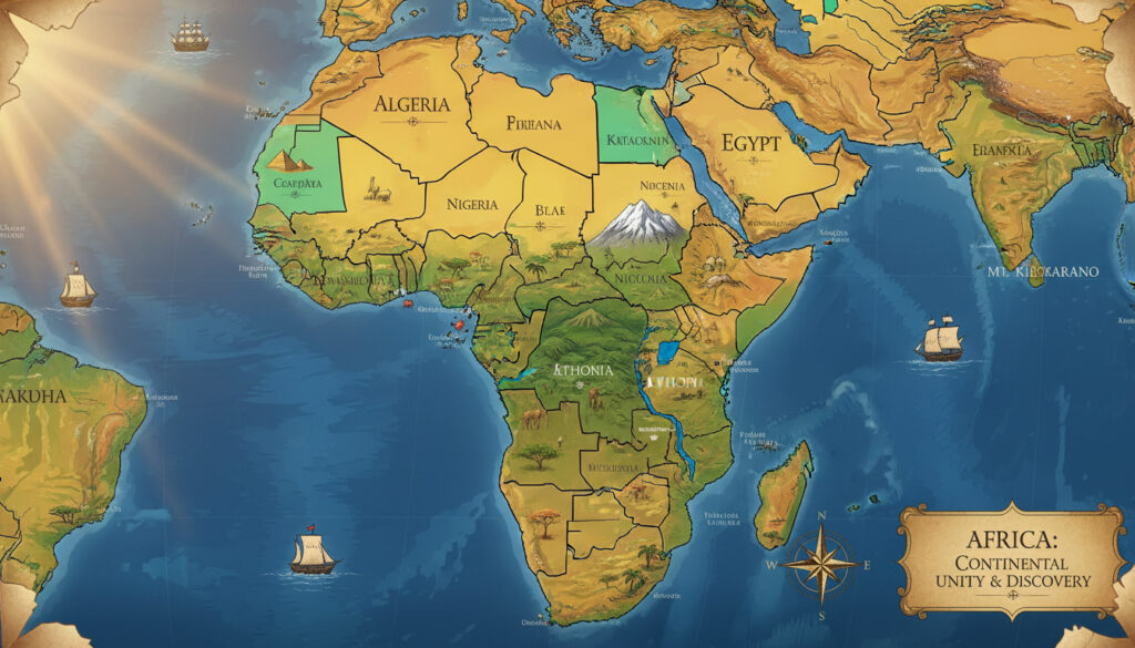
Map of African Countries – Labeled Printable Maps and 54 Nations Facts
Africa comprises 54 sovereign nations recognized by the United Nations, spanning approximately 30.37 million square kilometers. Political maps of the continent display these countries with boundaries largely established during the post-colonial era, though specific territorial disputes continue to affect definitive counts in certain regions.
Accurate visual representations serve critical functions across education, geopolitical analysis, and travel planning. Maps differentiate between mainland territories and six distinct island nations while highlighting the dramatic size disparities between the largest state, Algeria, and the smallest, Seychelles.
How Many Countries Are in Africa?
The universally accepted standard lists 54 fully recognized sovereign states. This figure includes 48 mainland countries and six island nations scattered across the Atlantic and Indian Oceans.
- 54 sovereign states hold full United Nations membership
- Six island nations (Madagascar, Mauritius, Seychelles, Comoros, Cape Verde, São Tomé and Príncipe) join 48 mainland countries
- Post-colonial borders established primarily between the 1950s and 1990s
- Two disputed territories (Western Sahara and Somaliland) appear on some maps but lack universal recognition
- African Union alignment generally follows the 54-state model while admitting the Sahrawi Arab Democratic Republic as a member
- Educational standard consistently uses this count for labeling exercises and geographic quizzes
| Region | Countries | Largest State | Key Feature |
|---|---|---|---|
| Northern | 6 (7 disputed) | Algeria | Mediterranean coastline |
| Western | 16 | Niger | Sahel and coastal plains |
| Central | 9 | DR Congo | Congo Basin rainforest |
| Eastern | 18 (19) | Ethiopia | Great Rift Valley |
| Southern | 5 (6) | South Africa | Kalahari Desert |
What Are All the Countries in Africa?
The 54 nations organize into five geographic regions recognized by the United Nations and African Union. Each region contains distinct cultural, climatic, and topographic characteristics reflected in political review maps with alphabetical country lists.
Northern Africa
Algeria, Egypt, Libya, Morocco, Sudan, and Tunisia form the core six, with Western Sahara frequently included as a disputed territory. Algeria dominates this region spatially, covering 2.38 million square kilometers of desert and Mediterranean coast.
Western Africa
Sixteen countries stretch from the Atlantic coast to the Sahel: Benin, Burkina Faso, Cape Verde, Côte d’Ivoire, Gambia, Ghana, Guinea, Guinea-Bissau, Liberia, Mali, Mauritania, Niger, Nigeria, Senegal, Sierra Leone, and Togo. Nigeria anchors this region as the most populous state.
Central Africa
Nine nations occupy the Congo Basin: Cameroon, Central African Republic, Chad, Congo (Republic), Congo (Democratic Republic), Equatorial Guinea, Gabon, and São Tomé and Príncipe. The Democratic Republic of Congo constitutes the largest landmass here.
Eastern Africa
Eighteen countries border the Indian Ocean, Red Sea, and Great Lakes: Burundi, Comoros, Djibouti, Eritrea, Ethiopia, Kenya, Madagascar, Malawi, Mauritius, Mozambique, Rwanda, Seychelles, Somalia, South Sudan, Tanzania, Uganda, Zambia, and Zimbabwe.
Southern Africa
Five recognized states occupy the southern cone: Angola, Botswana, Eswatini (formerly Swaziland), Lesotho, Namibia, and South Africa. South Africa serves as the economic and geographic anchor of this region.
Regional boundaries vary slightly between UN and African Union classifications. The AU admits the Sahrawi Arab Democratic Republic (SADR) as a member, affecting Northern Africa counts, while the UN maintains 54 member states total.
Best Maps of African Countries: Labeled and Printable
Educational and professional use demands precise cartographic resources. Multiple authoritative sources provide political maps in PDF vector format utilizing Lambert Azimuthal Projection with complete country borders and labels.
Political Maps
Comprehensive political displays show international boundaries, capital cities, and major geographic features. These representations utilize standardized color coding to distinguish sovereign territories while highlighting disputed zones with dashed or shaded overlays.
Blank Printable Versions
Blank outline maps in black-and-white and color formats facilitate educational labeling exercises. Resources include full continent views and individual country outlines from Algeria through Zimbabwe, optimized for A4 printing.
Interactive Options
Digital resources include labeled maps with quiz functions and answer keys listing all 54 countries. SVG and AI file formats allow customization for specific presentation needs or academic publication requirements.
High-resolution PDFs from educational repositories include alphabetical country lists on reverse sides. These worksheets verify labeling accuracy and provide context on ocean boundaries and neighboring continental masses.
Key Geography: Largest and Smallest African Countries
Dramatic scale disparities characterize the continental landmass, with the largest territory exceeding 5,000 times the area of the smallest sovereign state.
By Land Area
Algeria dominates North Africa and the entire continent at 2.38 million square kilometers. The Democratic Republic of Congo follows, encompassing 2.34 million square kilometers of Central African rainforest. Sudan, Libya, and Chad complete the top five largest territories. At the opposite extreme, Seychelles occupies merely 459 square kilometers of dispersed Indian Ocean islands.
By Population
While land area remains constant, population density varies dramatically. Nigeria hosts approximately 220 million residents within 923,768 square kilometers, while Seychelles maintains a population under 100,000 across its archipelago.
Map projections significantly distort apparent country sizes. Mercator projections exaggerate northern territories like Algeria and Libya while compressing equatorial regions such as the Democratic Republic of Congo, which appears smaller than Greenland on standard web maps despite being four times larger.
How Did the Map of African Countries Change Over Time?
Current political boundaries largely reflect decolonization movements and post-independence adjustments rather than traditional ethnic or geographic divisions.
- – Berlin Conference establishes colonial borders without African diplomatic participation
- – Year of Africa: 17 countries achieve independence from European colonial powers
- – Namibia gains independence as the last African colony to achieve sovereignty
- – Somaliland declares independence from Somalia; remains unrecognized internationally
- – South Sudan separates from Sudan, becoming the 54th internationally recognized state
- – Kingdom of Swaziland officially renamed Eswatini
Which Territories Are Definitely Counted Versus Disputed?
Cartographic standards and political recognition occasionally diverge, creating uncertainty in official counts.
| Established Information | Information That Remains Unclear |
|---|---|
| 54 UN member states with full sovereignty | Western Sahara status (claimed by Morocco, partially controlled by SADR) |
| Somaliland governed as independent since 1991 | International recognition of Somaliland sovereignty (0 UN member states recognize) |
| South Sudan universally recognized since 2011 | Border disputes between Ethiopia and Eritrea affecting precise boundary lines |
| Eswatini official name change acknowledged | Variations in educational map editions using outdated “Swaziland” nomenclature |
Why Do Political Maps of Africa Show Different Borders?
Colonial administrative decisions established most current boundaries during the late 19th and early 20th centuries. The 1884 Berlin Conference partitioned the continent among European powers without regard for existing ethnic, linguistic, or geographic realities. These arbitrary divisions persisted through independence movements, creating states that encompass multiple traditional kingdoms or split single ethnic groups across international frontiers.
Modern cartographic standards attempt to reconcile these historical legacies with current geopolitical realities. Digital navigation tools like Google Maps on Pixel display internationally recognized boundaries, while specialized academic resources may indicate disputed zones or administrative lines of control that differ from formal international recognition.
Regional organizations further complicate standardization. The African Union admits the Sahrawi Arab Democratic Republic as a member state despite its limited territorial control, while the United Nations excludes it from full membership. These organizational differences explain why some educational labeling worksheets show 55 entities while official counts maintain 54 sovereign states.
Where Does the 54-Country Standard Come From?
International organizations and geographic authorities converge on the 54-state model through distinct verification processes.
The United Nations recognizes 54 member states in Africa, each possessing full sovereignty and voting rights in the General Assembly. This count excludes dependent territories and entities with limited or disputed recognition.
United Nations Member States Registry
Standard geographic education utilizes the 54-country framework for labeling exercises and regional analysis, acknowledging that two additional territories—Western Sahara and Somaliland—appear on detailed political maps but lack universal sovereign status.
African Political Map Review
Political maps reflect current administrative reality where 54 sovereign entities exercise exclusive territorial control, while acknowledging contested zones through special symbology rather than definitive boundary lines.
What Are the Essential Facts About African Country Maps?
Africa’s political map comprises 54 internationally recognized sovereign states organized into five geographic regions, with Algeria and Seychelles representing the extremes of territorial scale. While standardized educational materials and Neighborhoods map references provide consistent labeling, users should verify whether specific resources account for disputed territories or utilize current nomenclature such as Eswatini versus the former Swaziland.
Frequently Asked Questions
Interactive map of African countries?
Digital platforms like GeoGuessr provide interactive labeling quizzes with downloadable PDF resources. These tools display all 54 countries with clickable regions and verification systems for educational use.
Countries in Africa by size?
Algeria ranks largest at 2.38 million km², followed by DR Congo, Sudan, Libya, and Chad. Seychelles remains smallest at 459 km², significantly smaller than most major cities.
Map of Africa PDF?
Free PDF downloads include political maps with labels, blank outline versions for educational testing, and regional breakdowns. Vector formats allow scaling without resolution loss for classroom printing.
What is the 55th country in Africa?
No 55th sovereign state holds universal recognition. The African Union admits 55 members including the Sahrawi Arab Democratic Republic (Western Sahara), but the UN recognizes only 54 member states.
Is Somaliland on the map?
Somaliland appears on detailed political maps showing administrative divisions, but lacks international recognition as a sovereign state. It functions independently since 1991 yet remains officially part of Somalia in UN records.
How many regions does Africa have?
Five geographic regions organize the continent: Northern, Western, Central, Eastern, and Southern Africa. Regional designations follow UN and African Union classification systems.
Are there printable blank maps?
Educational institutions provide blank outline maps in PDF format suitable for student labeling exercises. These resources typically include answer keys listing all 54 countries alphabetically.
More related posts
 45 kg to lbs | Convert 45 Kilograms to Pounds (99.21 lbs)
 What Is Red 40? Side Effects, Bans, and Safety Explained
 Just Bare Chicken Nuggets – Nutrition Cooking Reviews Guide
 How to Do a Google Image Reverse Search (2025)
 How to Turn Off Vanish Mode on Instagram (iPhone, Android, PC)
 Minnesota Vikings vs Green Bay Packers Player Stats: Jan 4, 2026
 Boston to New York: Train, Bus, Flight Comparison